


Beyond the Bisti Badlands, another, larger wilderness area stretches for thousands of acres across some of the most desolate land in the state: the De-Na-Zin Wilderness.
 I was alone when I visited the Bisti Badlands, except for my dog Cassidy. After seeing my photos from that trip, my spouse Steve was eager to join me in exploring the area I had only glimpsed in September. So a few weeks later, in mid-November of 2006, we returned to see what we could find.
 Only about 10,000 people a year visit the Bisti Badlands, not many compared to most parks around the country. But the De-Na-Zin sees only one tenth of that number. While both spaces seem empty, this area truly is. The two areas together cover 45,000 acres, and are contiguous. It is possible to hike from one end to the other, although you'd have to carry quite a lot of water. There are no facilities at all. Horseback riding is permitted, and it seems that would be ideal, if you had ponies rugged enough to forage in this barren terrain.
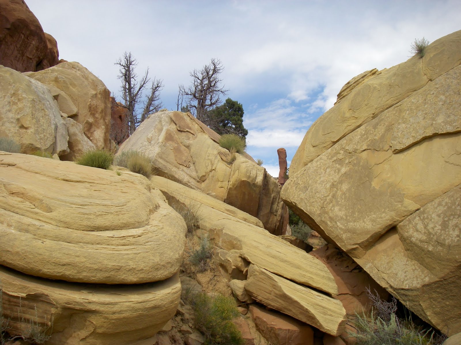
 The De-Na-Zin lies upstream from the Bisti, in the same watershed. To say upstream is deceiving, as there is no water flowing in the dry arroyos. The area was carved from an ancient seabed by the glaciers, thousands of years ago. Here you can see the layers of sedimentary rock that were deposited on the floor of a vast inland sea that covered much of the interior of our continent during the Cretaceous period.
  As in the Bisti, there are many petrified logs to be found here. I imagine these may have been species similiar to the cypress of the bayous of Louisiana, adapted to live in shallow water. Many have a similar shape, with the base of the trunk gracefully flared. Although we didn't find any, dinosaur fossils are also sometimes discovered here.
 The eastern end of the De-Na-Zin is composed of colorful shales from the Kirtland formation. Further west and lower in elevation, in the Bisti Badlands, the Fruitland Formation is exposed. This is composed of sandstone, mudstone, coal, shale, and silt; a rich combination of rocks which respond in different ways to the persistent touch of wind and rain.
 The basin receives only around eight inches of rain a year, and plant and animal life is scarce. A rare seep we chanced upon showed signs of life; bird, deer and coyote tracks in the mud. Such a water hole is a precious resource here. Cassidy, of course, drank her fill.
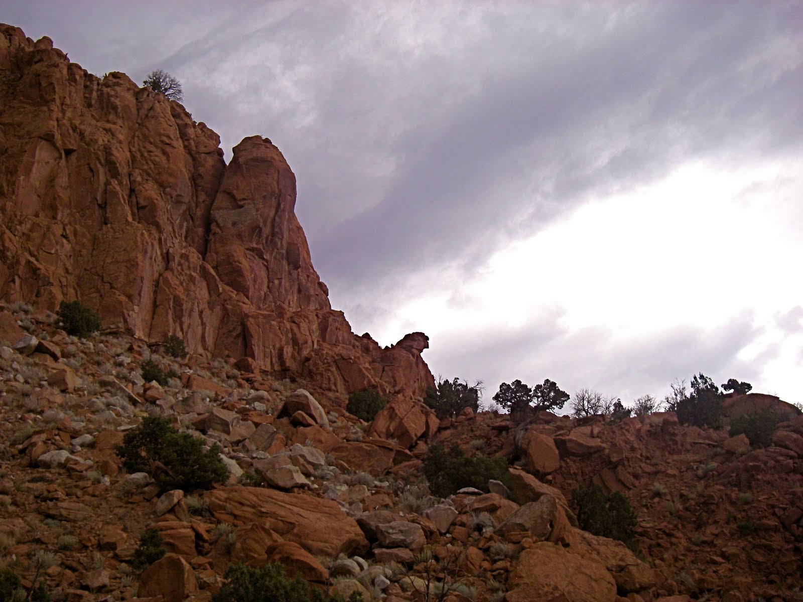
 Bizarre hoodoos dot the trailess landscape. This is a designated wilderness area and very remote. A GPS is recommended, if you don't have a Cassidy.
 In researching for this blog entry, I learned that we were not supposed to climb on the geologic features. I didn't see any sign stating this, and so I want to pass this and other restrictions on now.
- No mountain bike or motorized vehicles.
- No campfires, no collecting of fossils or petrified wood.
- No groups of more than eight people.
- No trespassing on tribal lands.
- Grazing, scientific research, and commercial guides need permits.
 I don't believe that our presence caused any harm to these features. We only climbed on ones that were solid. However, there are hoodoos and other structures which could be damaged that way, so please use good judgement!
 Don't climb this one, for example!
 Nor these.
 I apologize for the smudged photo, but had to show you these formations regardless. Aren't they beautiful? It is an amazing place, and refreshingly devoid of trash, graffiti, and other reminders of "civilization".
 For all of the variation in these photos, we were only there for a few hours. It would be wonderful to hike in and spend several days exploring. The light for photography would be much better near dawn and dusk.
 Another hoodoo...love that word!
 This formation was fascinating.
 It turned out to be an enormous petrified log. Note the packrat nest in the end.
 Here's another huge log. Steve has a reach of well over six feet, so you can see how big this tree was.
 OK, I know now that this was a no-no. Very sorry, won't do it again!
 We ran across some rock which evidently had a high iron content, to guess from the rusty coloration.
 More wonders.
 And more...
 A perfect mushroom. This was taken in mid-November, so we were dressed for cold weather. Spring and fall are the best times to visit this area, as summer temperatures can soar to over 100 F, and monsoon rains or snow can make the dirt roads impassable. Hats are a necessity, and layers are a good idea. It's important to be aware of weather conditions.
 A last look at some petrified logs before we headed back to town. It is a long way to go for a one-day trip( over three hours each way), but the nice thing about going with Steve is that we have good long conversations in the car. I can't wait to go back and spend a longer time there. We barely touched the fringe of this amazing place!


